


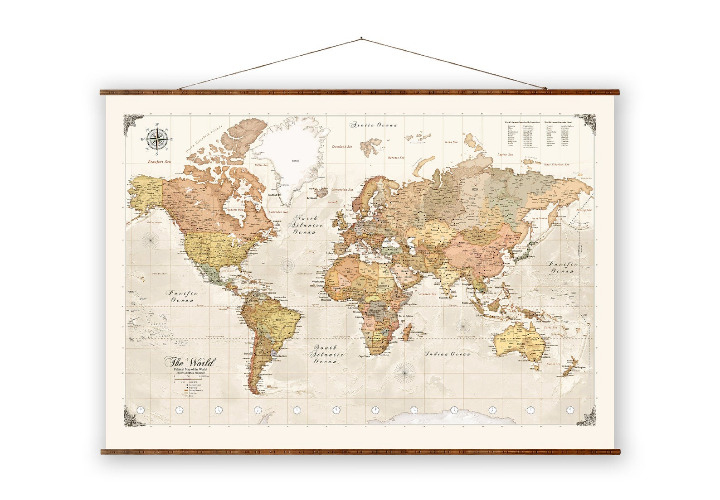
Map of Commercial Towns & Trade Routes 13th & 14th Centuries Historical Print

 4.0 (59 items)
 Limited Time Sale
$5.18 cheaper than the new price!!
Free cash-on-delivery fees for purchases over $99
Product details
| Management number | 7253819 | Release Date | 2025/08/21 | List Price | $7.77 | Model Number | 7253819 | ||
|---|---|---|---|---|---|---|---|---|---|
| Category | |||||||||
This antique map provides a detailed depiction of the commercial towns and trade routes during the 13th and 14th centuries. It offers a glimpse into the past, showcasing the intricate network of trade that spanned Europe, Asia, and Africa. A valuable addition to any historical collection, this map is printed on aged paper, adding to its vintage charm.
• Depicts historical trade routes
• Approx. 10"x8"
• Aged paper
• Suitable for framing
• Rich in historical detail
Crease along the center fold; paper shows natural age discoloration.
Thanks for looking!
| Category | Vintage & collectibles > Paper ephemera > Map |
|---|---|
| Size | N/A |
| Brand | Unique Vintage |
| Condition | Good |
Map


Bowl


Correction of product information
If you notice any omissions or errors in the product information on this page, please use the correction request form below.
Correction Request Form